
Day 27 - Heatmap - EAT MAP TOKYO

Day 29 - UCL CASA Animated 3D Map
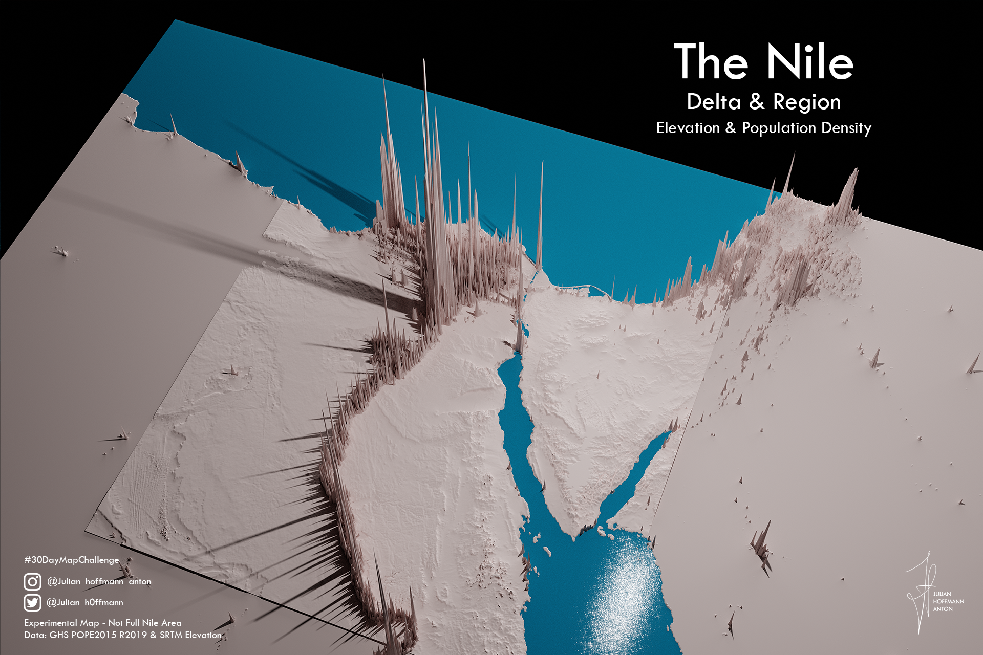
Day 23 - GHSL - Nile Region Population

Day 2 - Lines - London Neon_Arteries

Day 17 - Land: 3D Lego Globe of Land Areas
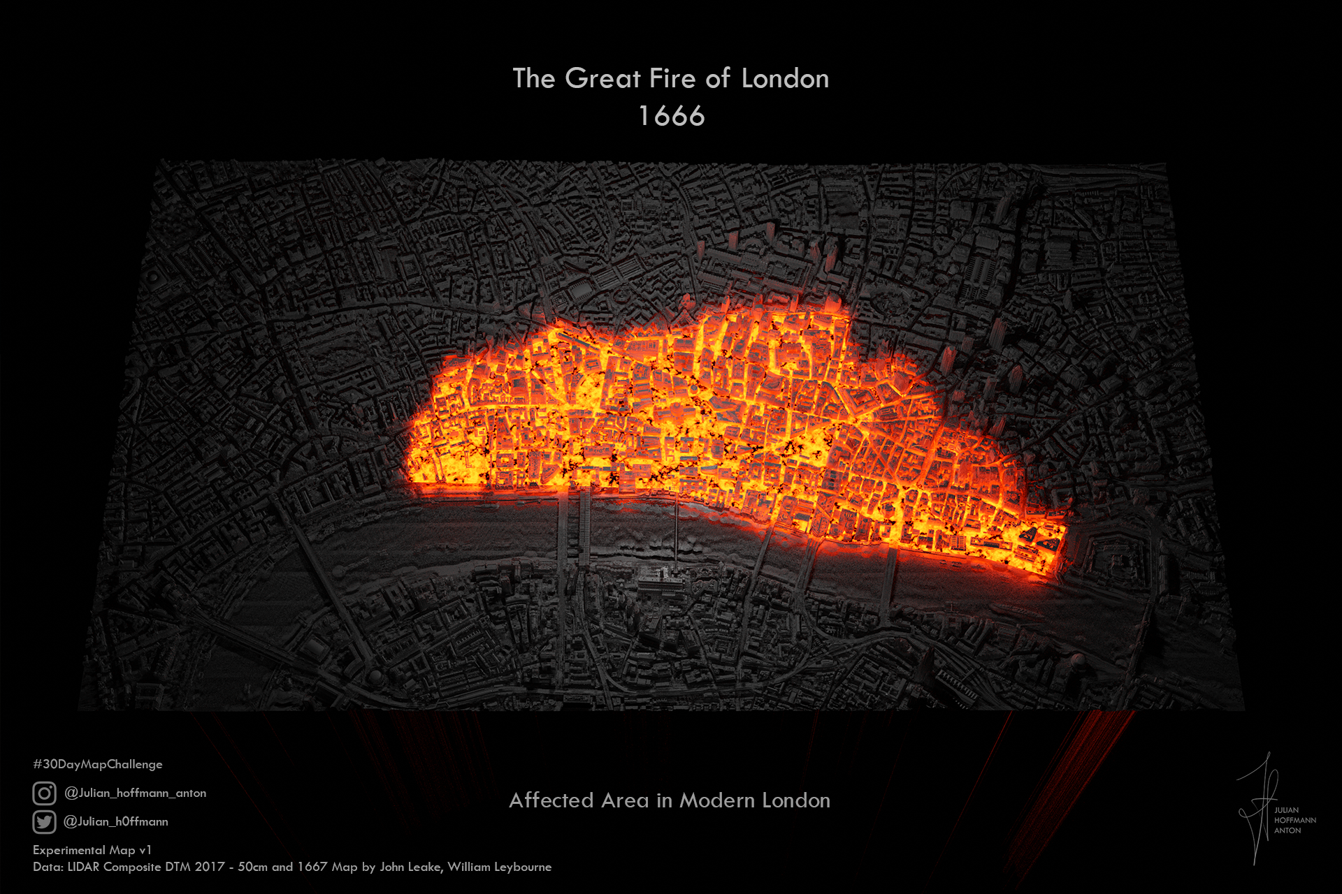
Day 24 - Historical Map - The Great Fire of London

Day 20 - Movement - Vessel Density

Day 11 - 3D - London: Spinning my Labyrinth

Day 21 - Elevation - Pop.Suisse
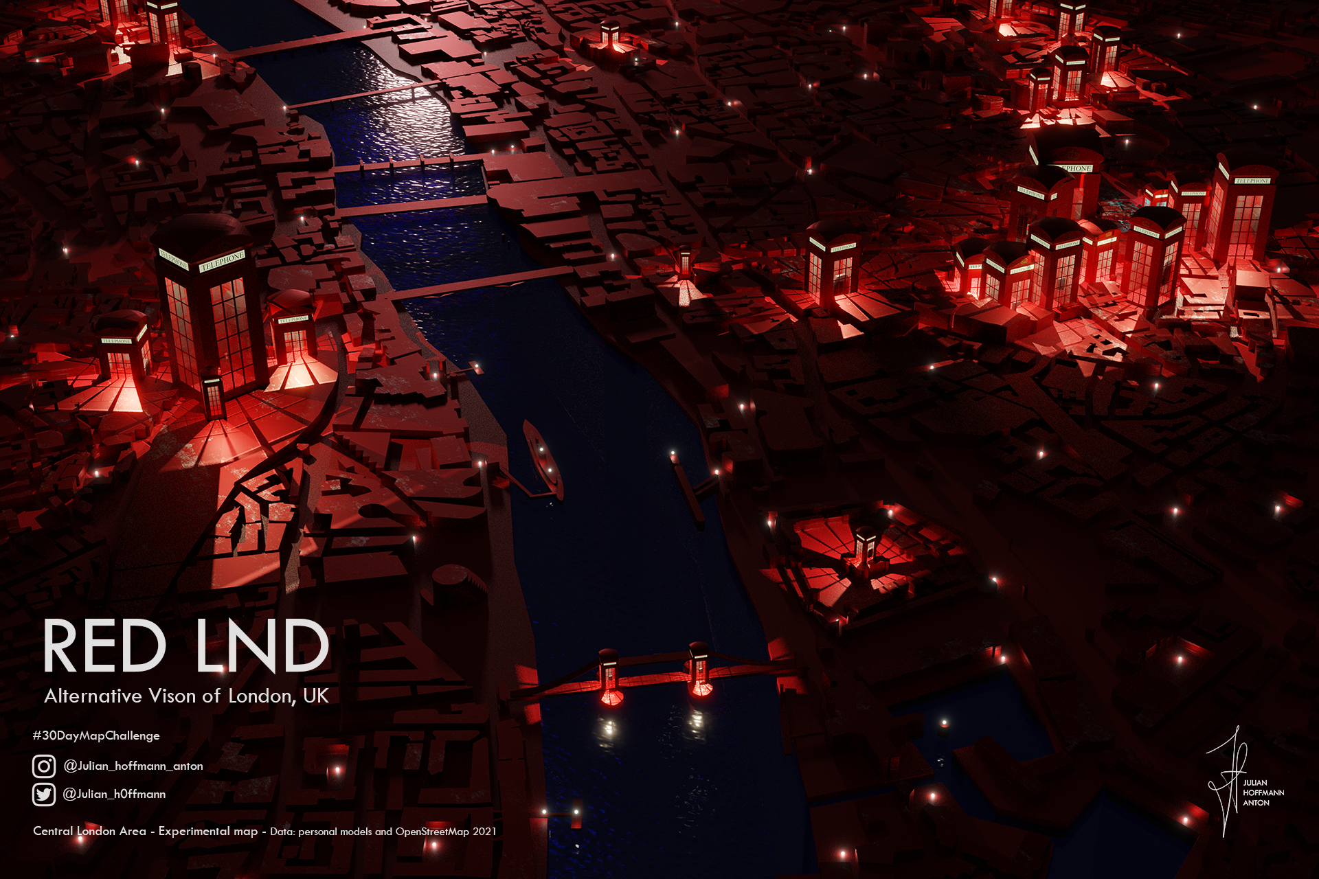
Day 6 - Red - RED LND

Day 3 - Polygons - 99 Pop. Balloons

Day 28 - The Earth is Not Flat

Day 4 - Hexagons - Densité de Cafés à Paris

Day 5 - Open Street Map: All Eyes on Glasgow
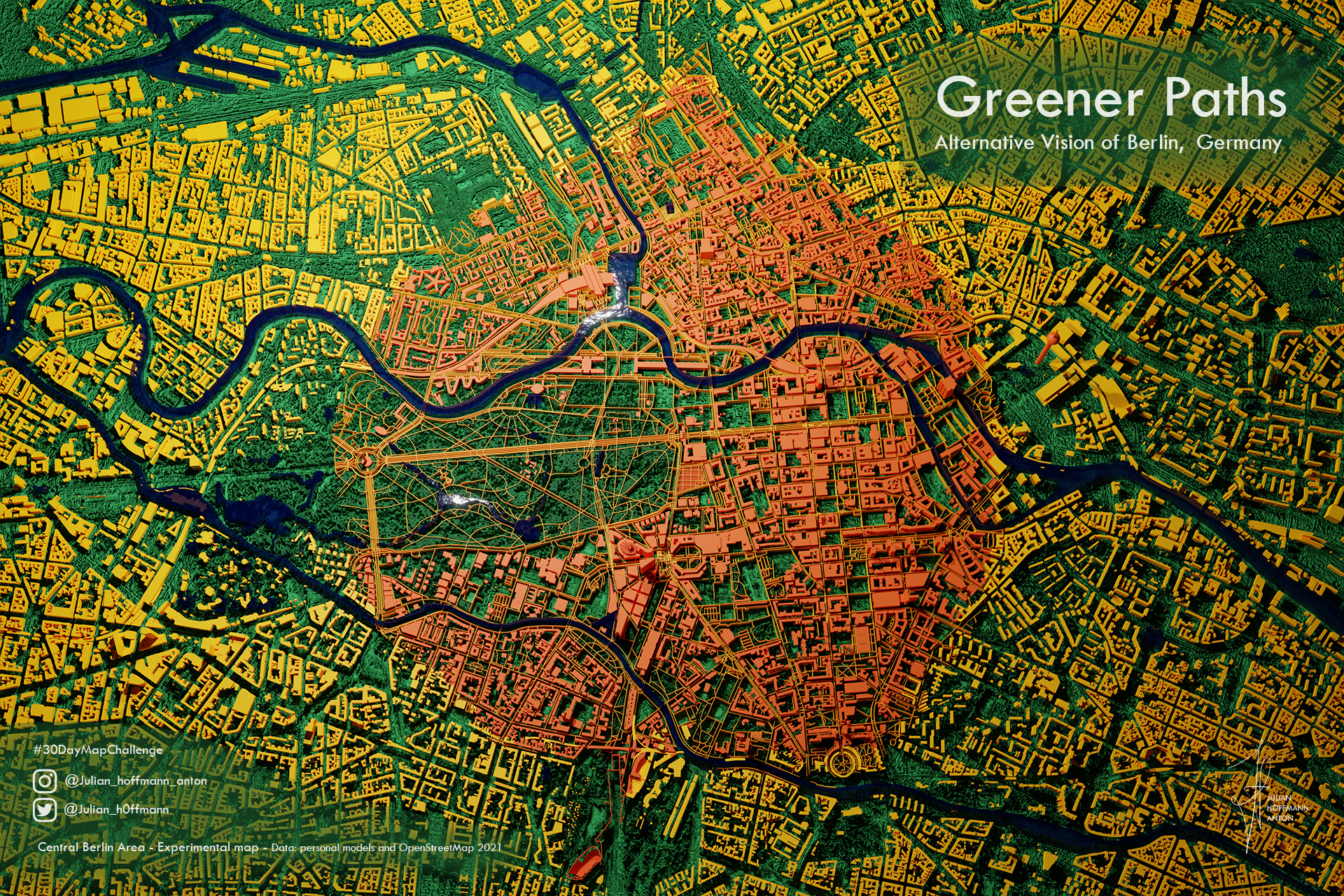
Day 6 - Green - Greener Paths in Berlin

Day 12 - Population : World Pop.
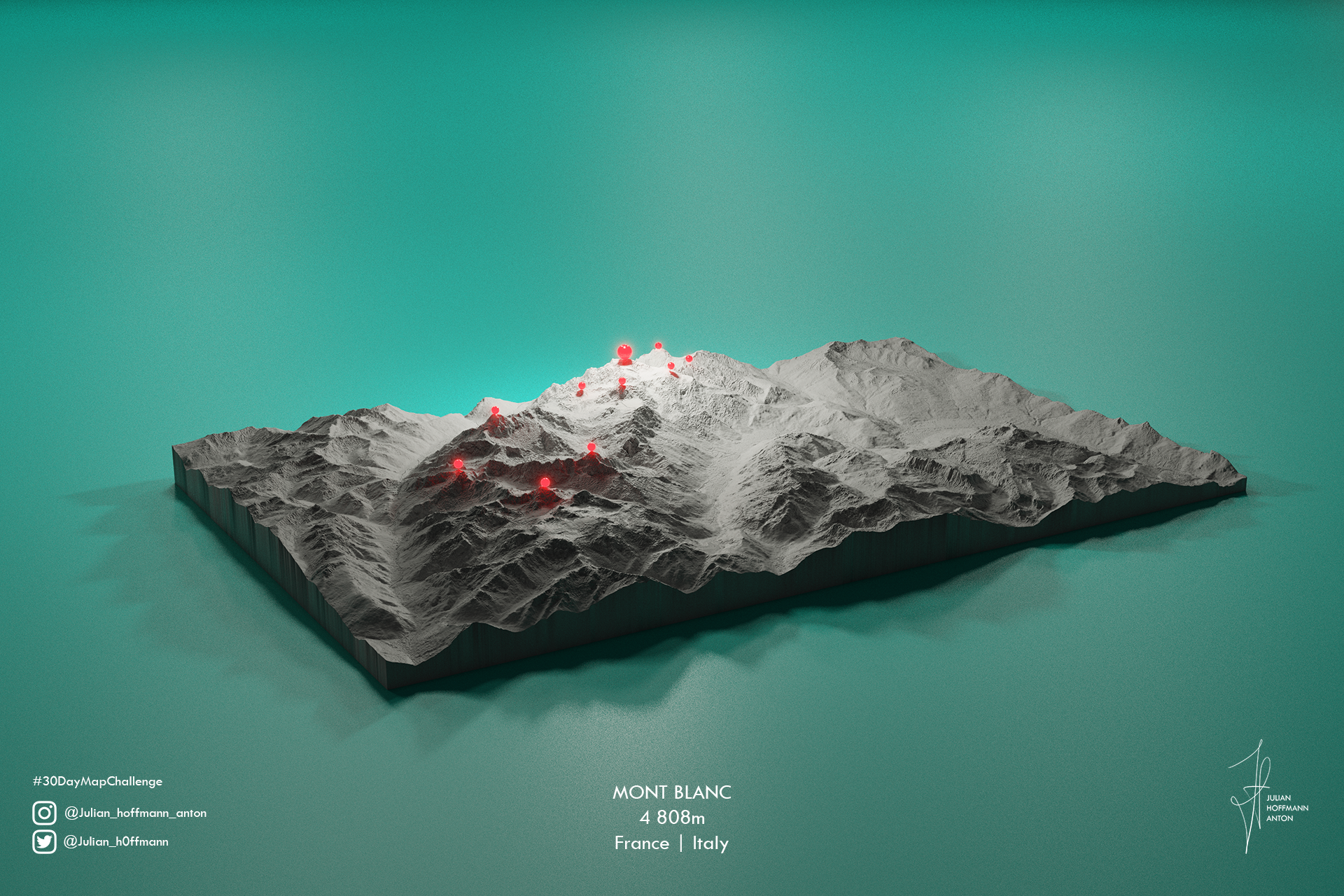
Day 1 -Points: Highest points in Western Europe

Day 9 - Monochrome: Barcelona Vision

Day 10 - Raster: Rasterized World Map

Day 13 - Natural Earth - Urban Areas

Day 14 - Map with a new tool: Lego NYC

Day 15 - Map Without a Computer / Meta : Meta-Mind-Map

Day 16 - Urban vs Rural: London Central Activities Zone.

Day 18 - Water- Liner Shipping Connectivity Index - Ports
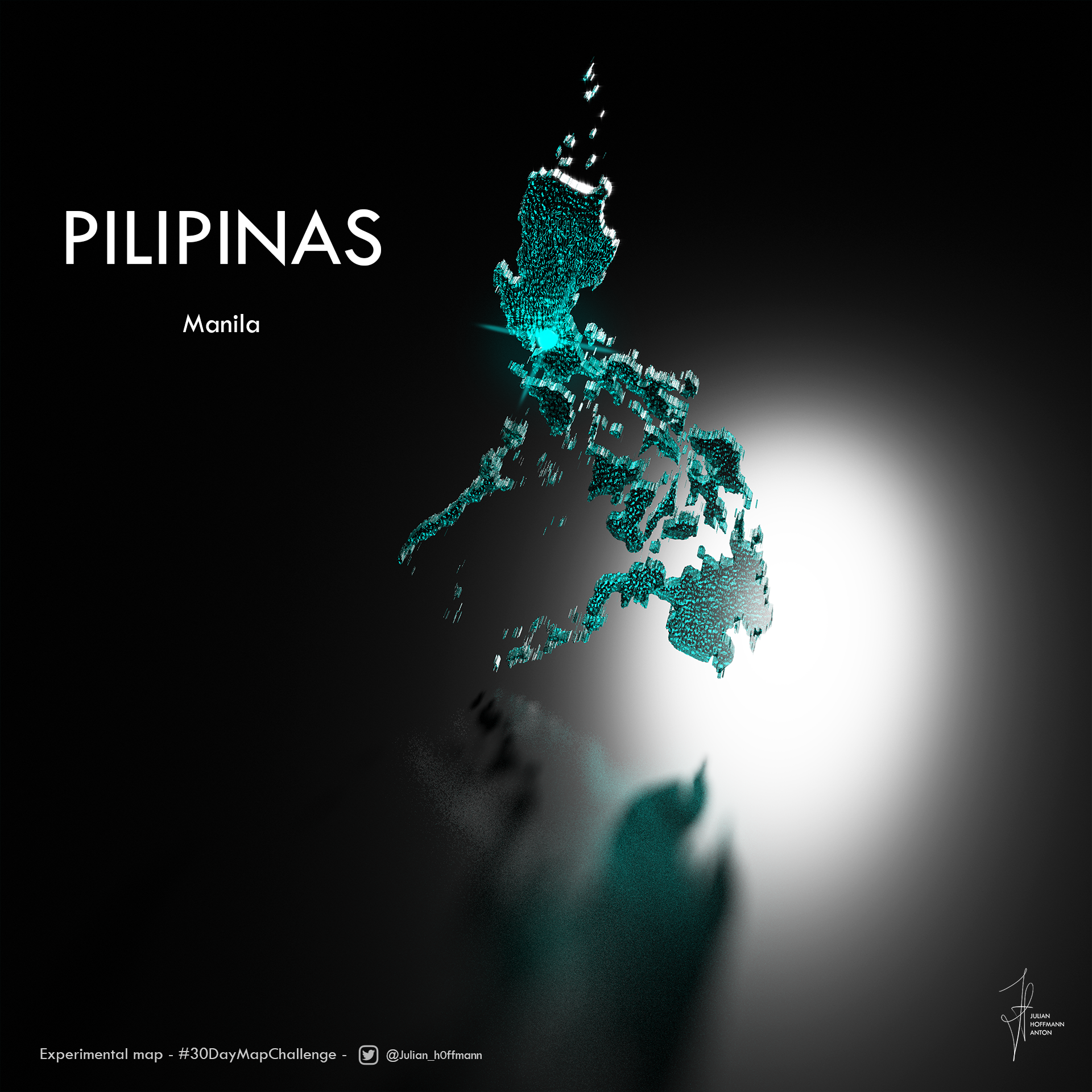
Day 19 - Islands - Pilipinas

Day 22 -Boundaries - Capital Centered Countries
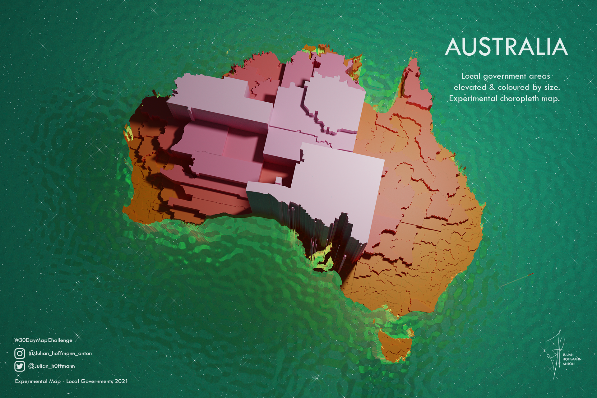
Day 26 - Choropleth - Australia Local Authorities

Day 18 Water: Blue Marble

Day 5 - Interactive Map - Liner Shipping Connectivity Map - Ports

Day 30 - Meta : Never Ending Maps
Day 27 - Heatmap - EAT MAP TOKYO
Day 29 - UCL CASA Animated 3D Map
Day 23 - GHSL - Nile Region Population
Day 2 - Lines - London Neon_ArteriesMade in Blender.
Day 17 - Land: 3D Lego Globe of Land Areas
Day 24 - Historical Map - The Great Fire of London
Day 20 - Movement - Vessel Density
Day 11 - 3D - London: Spinning my Labyrinth
Day 21 - Elevation - Pop.SuisseMade in Blender.
Day 6 - Red - RED LND
Day 3 - Polygons - 99 Pop. Balloons
Day 28 - The Earth is Not Flat
Day 4 - Hexagons - Densité de Cafés à Paris
Day 5 - Open Street Map: All Eyes on Glasgow
Day 6 - Green - Greener Paths in BerlinMade in Blender.
Day 12 - Population : World Pop.World Cartogram of Population by country.
Day 1 -Points: Highest points in Western Europe
Day 9 - Monochrome: Barcelona VisionMade in Blender. Data OpenStreetMap
Day 10 - Raster: Rasterized World Map
Day 13 - Natural Earth - Urban AreasMade in Blender. Data: Natural Earth - Urban Areas
Day 14 - Map with a new tool: Lego NYCMade in Blender with geometry nodes. Data: OpenStreetMap
Day 15 - Map Without a Computer / Meta : Meta-Mind-MapMindmap of 95% of my map-making process
Day 16 - Urban vs Rural: London Central Activities Zone.Made in Blender and R.
Day 18 - Water- Liner Shipping Connectivity Index - Ports
Day 19 - Islands - PilipinasMade in blender and R.
Day 22 -Boundaries - Capital Centered Countries
Day 26 - Choropleth - Australia Local AuthoritiesMade in Blender and R. Mainly ggplot and sf
Day 18 Water: Blue Marble
Day 5 - Interactive Map - Liner Shipping Connectivity Map - PortsInteractive file: Download and Open in Browser: https://www.dropbox.com/s/vhfeetmeo32qf7a/interactive_UNCTAD_PLSCI_port_connectivity_index_2021Q3_v1_Julian_Hoffmann.html?dl=0
Day 30 - Meta : Never Ending MapsMade in Blender.
info
/
1
2
3
4
5
6
7
8
9
10
11
12
13
14
15
16
17
18
19
20
21
22
23
24
25
26
27
28
29
30
·
·
·
·
·
·
·
·
·
·
·
·
·
·
·
·
·
·
·
·
·
·
·
·
·
·
·
·
·
·